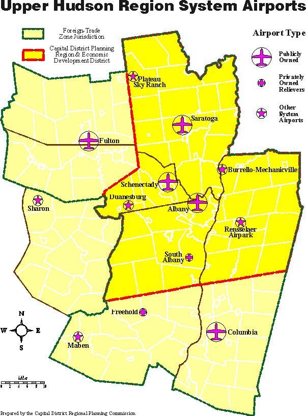
 Albany International Airport
  Plateau Sky Ranch Airport
  Burrello-Mechanicville Airport
  Rensselaer County Airpark
  Columbia County Airport
  Saratoga County Airport
  Duanesburg Airport
  Schenectady County Airport
  Freehold Airport
  Sharon Airport
  Fulton County Airport
  South Albany Airport
  Maben Airport
 Return to CDRPC Home Page