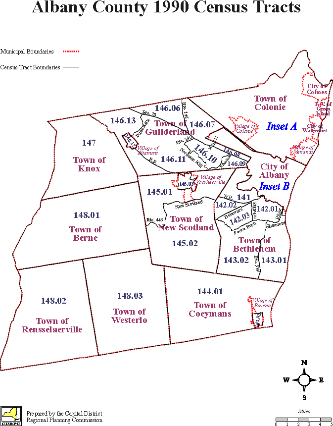
 Albany County Census Tracts
 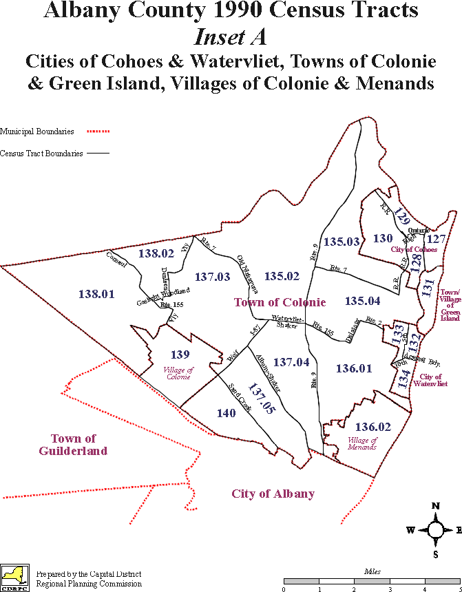 Cohoes, Watervliet, Colonie, Green Island, Villages of Colonie & Menands
 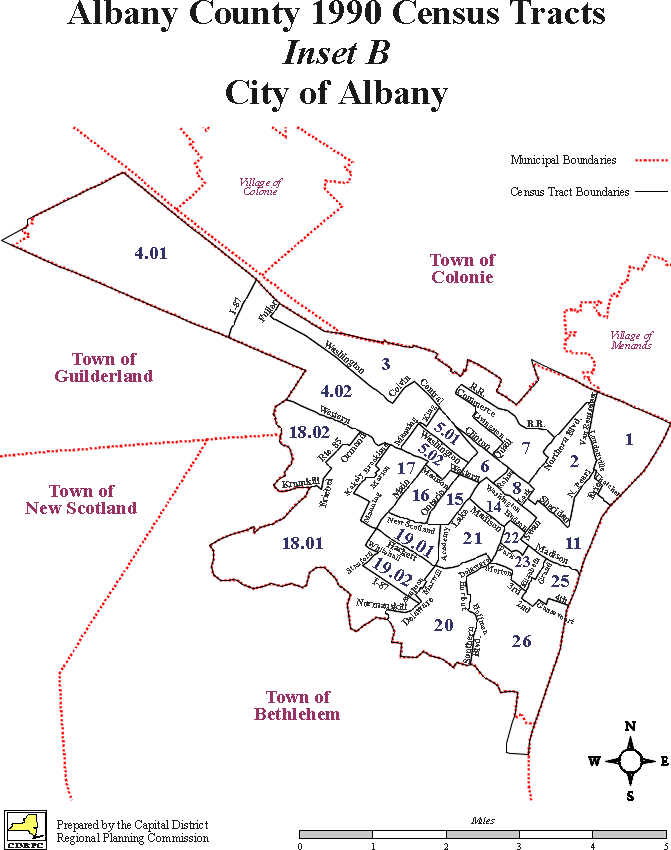 City of Albany
 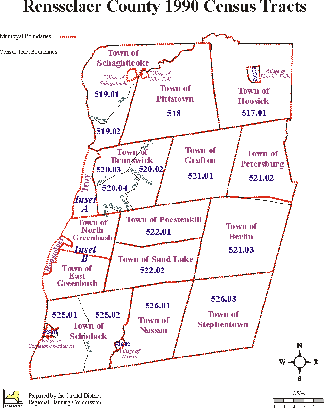 Rensselaer County Census Tracts
 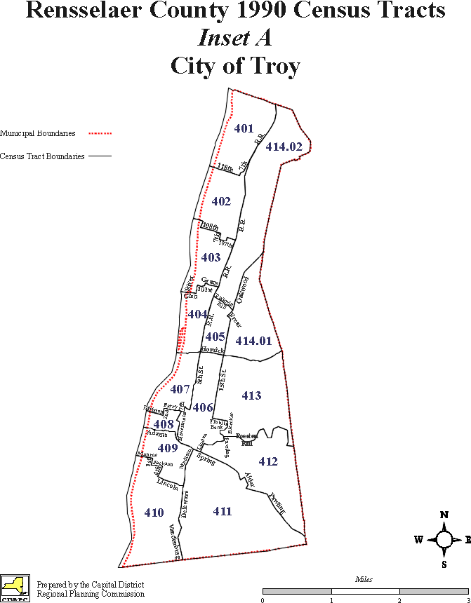 City of Troy
 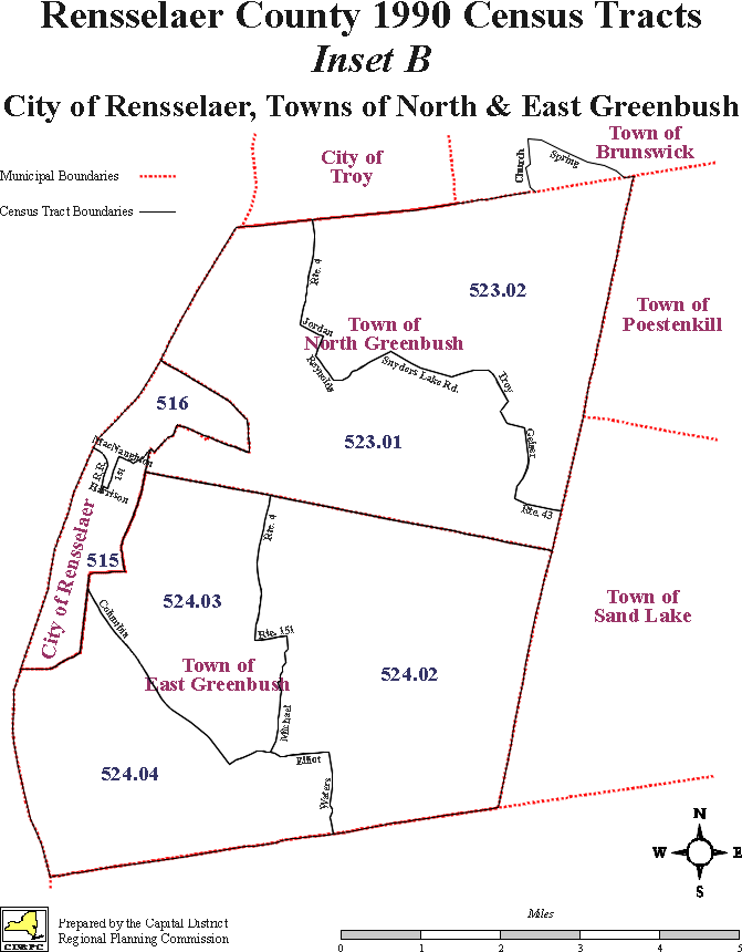 City of Rensselaer, Towns of North & East Greenbush
 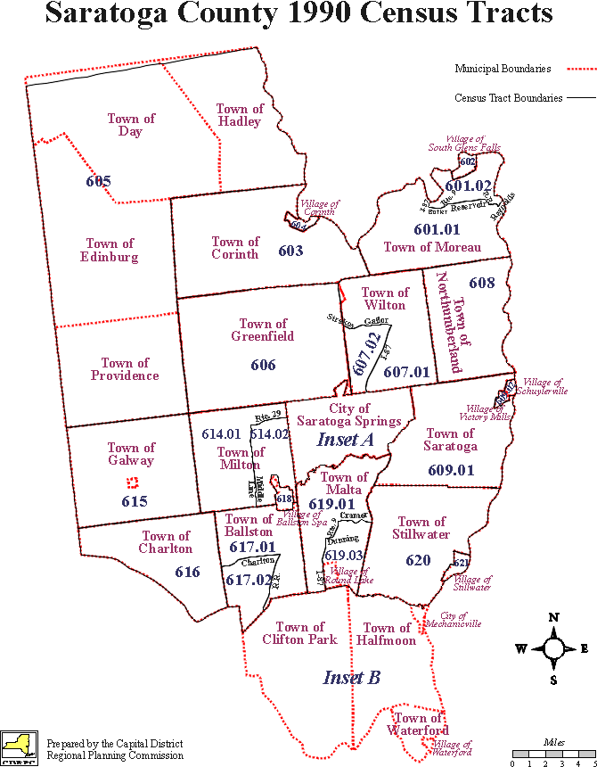 Saratoga County Census Tracts
 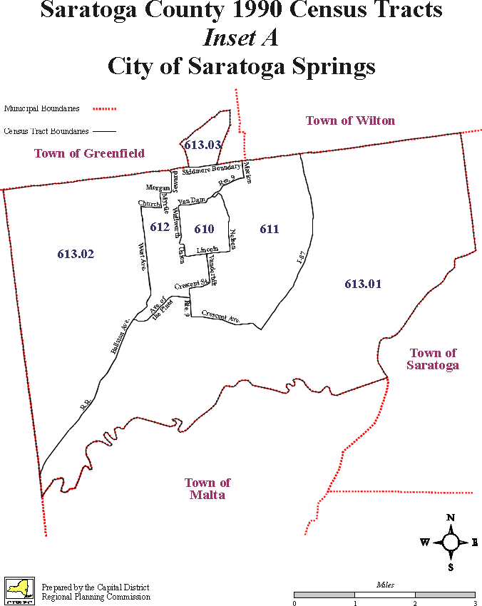 City of Saratoga Springs
 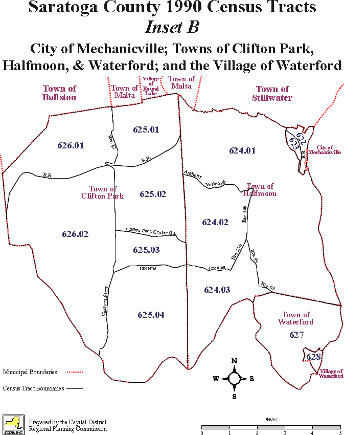 Mechanicville, Clifton Park, Halfmoon, Waterford, Village of Waterford
 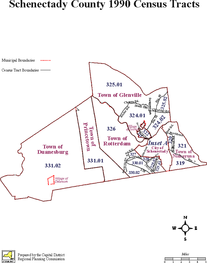 Schenectady County Census Tracts
 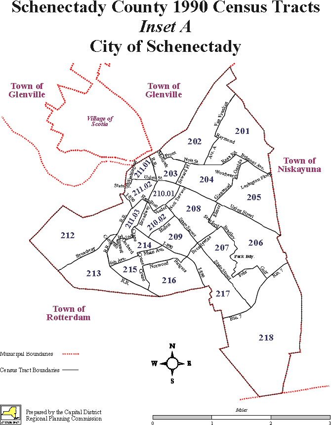 City of Schenectady
  Return to CDRPC Home Page